Whether or not there’s a pandemic going on, hiking is one of the best activities that you can be doing; for your physical and mental health, for your wallet, and for your collective bonds with other people.
Before you go to any of these places, please check on Google and Facebook to confirm that they’re open and comply with any and all guidance about parking, park capacity and best practices.
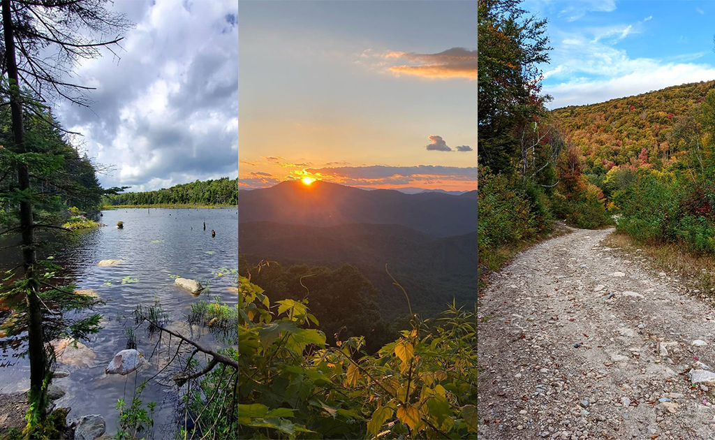
We’ve already covered New Hampshire, Massachusetts and Maine in our series of the most-Googled hikes in every state; today, we’re looking at Vermont.
As always, we collected data from Google and averaged out how many times people are searching for every hiking location in Vermont in a given month. We then called up some Vermont hiking experts to get their anecdotes and tips on every location. They are:
Sherry Winnie, M.P.A., Recreational Trails Program Manager, Vermont Department of Forests, Parks and Recreation
Shelby Semmes, Northern New England Area Director, The Trust for Public Land
Amy Potter, Visitor Center Manager, Green Mountain Club
Stephanie Kyriazis, Chief Chief of Interpretation, Education and Visitor Services, Marsh-Billings-Rockefeller National Historical Park & Saint-Gaudens National Historical Park
Keld Alstrup, Board Member, Merck Forest
Once again, there is no guarantee if these hikes will be open or will have parking available, so please double-check before you go out to one.
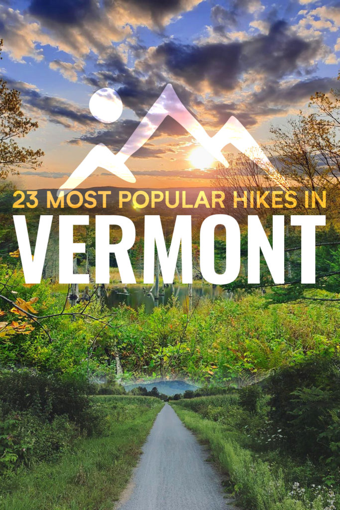
Onto the list!
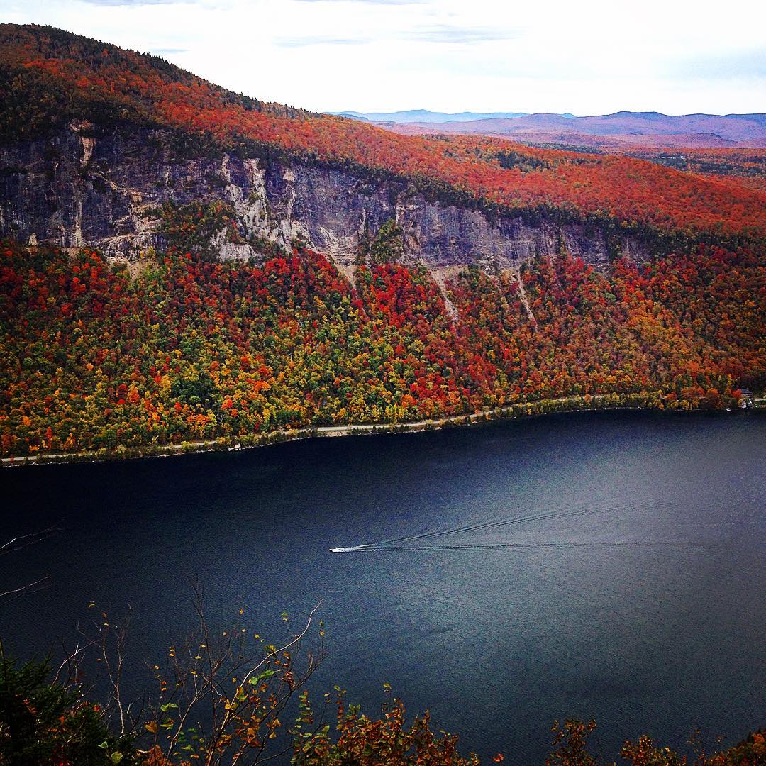
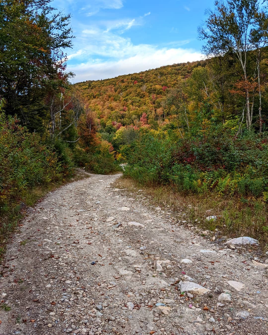
1. Mount Pisgah
6,200 Monthly Searches
COVID-19 less popular alternative: Clyde River Access Trail
Check here for the latest advisory before you go.
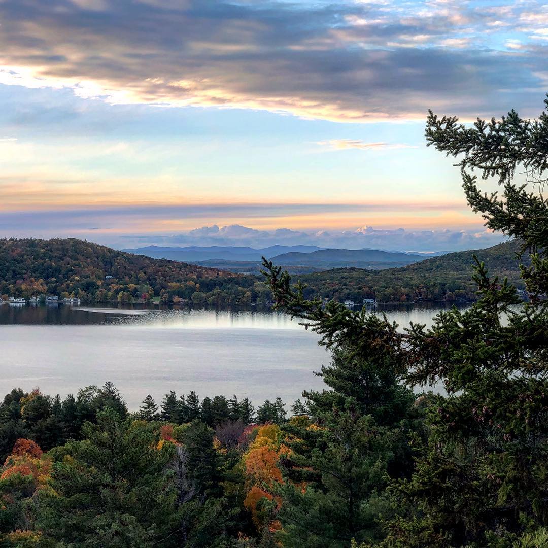
Sherry: It was one of my first hikes I went on in the North East Kingdom (before I got this job). It’s like a Scandinavian fjord! There’s nothing like this area any other place in Vermont. When I went up to Lake Willoughby, I was so amazed. You see Mount Pisgah on one side of the Lake, and Mount Hor on the other. Each mountain has amazing vistas of the Lake. It’s an incredible landscape, the lake is beautiful and after a day’s hike you can take a swim at either end of Lake Willoughby, or just soak in the view. Both North and South ends of Willoughby have public beaches. There are cabins to rent at the north end and at the South end is a public beach surrounded by Willoughby State Forest. It’s an amazing area. Sentinel Rock State Park is a short drive to the north of Lake Willoughby. From there you can get another spectacular view of Willoughby State Park. There’s also great biking on Route 5. Lake Willoughby region is a world all its own. You can’t help but go to check this area out. There are all-season trails up there: a 12-mile cross country skiing trail system in Willoughby State Forest, and some new glades for back-country skiing in Willoughby State Forest on adjacent Bartlett Mountain. And if you travel south from Willoughby down to Burke you can get on miles and miles of mountain bike trails that are part of the Kingdom Trails Association’s trail network or go over to Burke Mountain for more outdoor fun hiking, biking, and skiing.
Amy: It’s beautiful, moderately difficult. It’s a sustained uphill, but when you get to the top, and it’s one of the prettiest spots in Vermont. Huge cliffs on each side and you can look out over the lake. It feels like you can be in Hawaii or some other place outside Vermont.
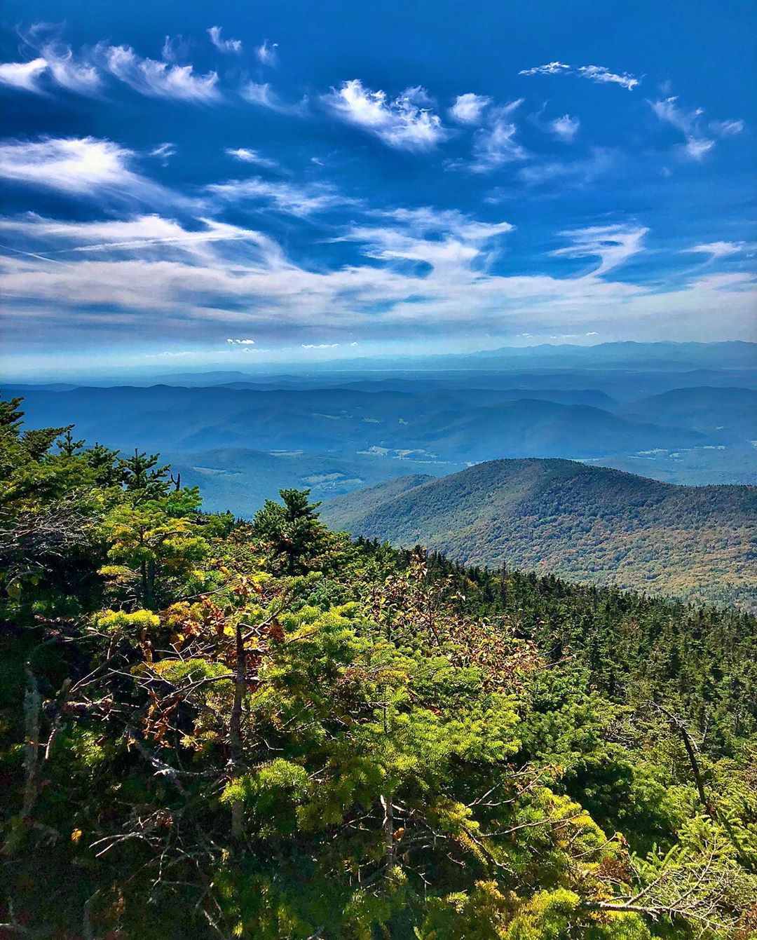
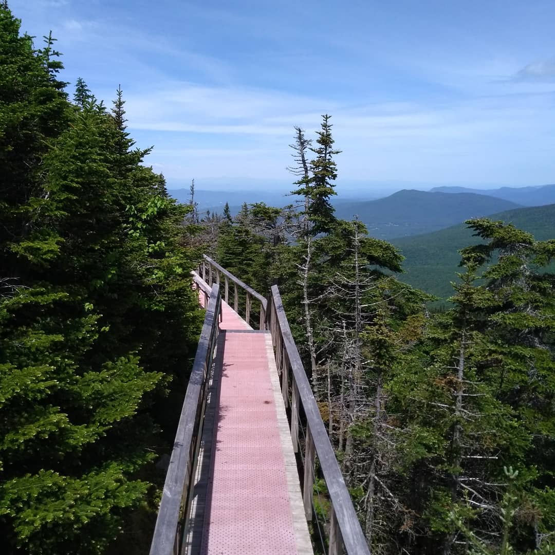
2. Mount Mansfield
5,700 Monthly Searches
COVID-19 less popular alternative: Mount Mansfield State Park
Check here for the latest advisory before you go.
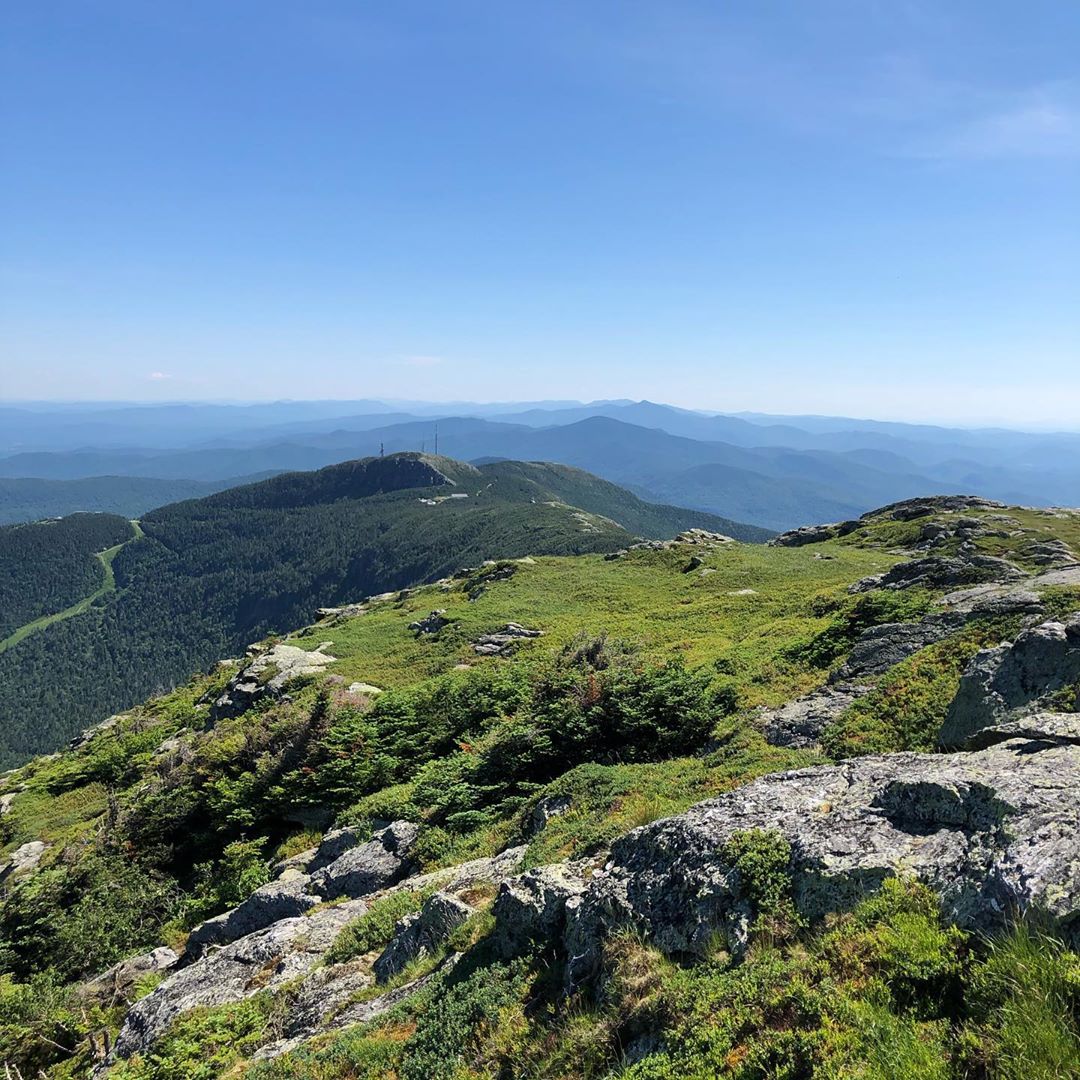
Sherry: Do you want to hike up the nose, or the chin? It’s an amazing mountain, you can get up through Stowe or Underhill State Park.
I did the chin years ago. I’m glad that I did. Hikers should know it’s very steep, and difficult terrain. You could also climb up, taking your time, on other difficult trails that are not the chin… there is a series of small connectors to get up to Maple Ridge and Laura Coles Trail. But I like taking the Sunset Ridge trail, I like that it’s sunny side up and sunny side down. It leads you to a view of a cantilever boulder embedded into the mountain (“Cantilever Rock”), where there’s this huge rock in cantilever position. I picnicked at this spot once about 15 years ago.
By the way, it’s the highest peak in Vermont. A must do. I’ve hiked Mt. Mansfield a few times.
Amy: Our biggest mountain, there are lots of ways up Mansfield. There’s lots of trail options and little side trails that go in and out of caves and cliffs. You go through a lot of environments. You have hardwoods at the bottom, then you enter more softwoods with little spruce trees, then an alpine zone with lots of rock scrambles. You can pick ways that are fairly moderate up to extremely difficult.
3. Camel’s Hump
3,000 Monthly Searches
COVID-19 less popular alternative: Duxbury Window Trail
Check here for the latest advisory before you go.
Sherry: It’s a national natural landmark in Vermont which protects it from being developed. The designation was given to Camel’s Hump in the 1960s through the National Parks Service. If you go up to the trails from Duxbury, you can get on the Monroe Trail, which gets you up the summit, which then leads to the Dean Trail that splits. Along the Dean Trail an airplane crashed into the mountain. The plane looks embedded into the mountain, with vegetation grown all around it with parts of that airplane still visible (it’s something to see from a little distance, not up close, so as to not disturb the ground or create erosion near the area)
Take the Monroe Trail (named after Bill Monroe), all the way to the summit and take a small section hike all the way South along the Long Trail to Middlebury Gap. And think about Bill. He was the one who built the Long Trail Section from Camels Hump to Middlebury Gap.
He traveled the world, loved to hike, build trails, and write. Never married and loved dogs. Matter of fact, you will find his dogs buried in the old fenced-in cemetery behind the old caretaker’s cabin near the Monroe Trailhead area. Check out the history. It’s a great story.
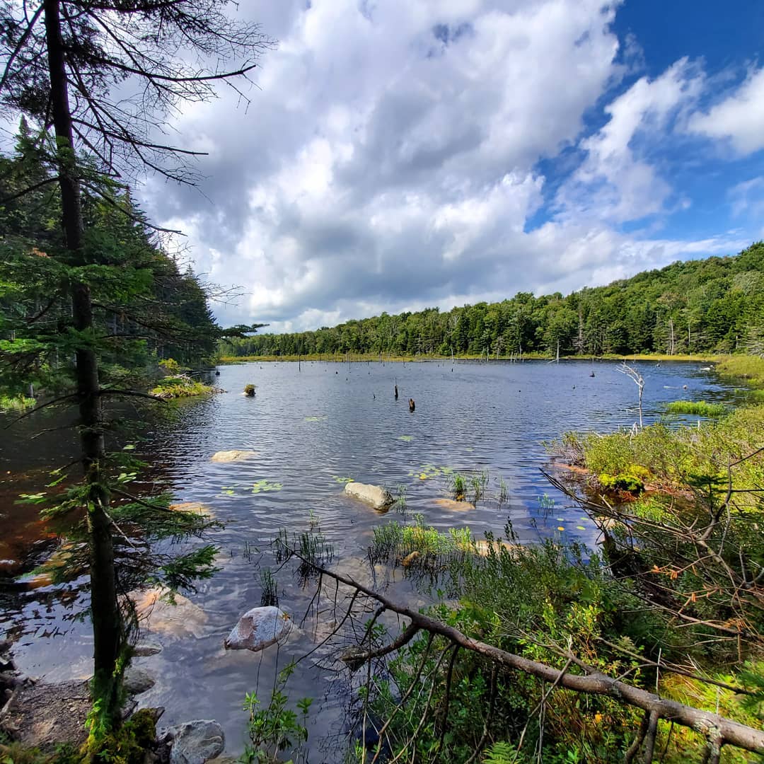
And if you’re not up for a hike to the Summit, just before the Monroe Trailhead Parking area, there’s a parking area to the left for the Camel’s Hump View trail, a one-mile easy loop trail from the trailhead parking area. You’ll even find another adventuresome trail system leading off of it called the Ridley Brook Trail, which will lead you to a VAST (Vermont Association of Snowmobile Trail) trail, part of the Statewide VAST trail system, and if you head north on the VAST trail and walk up hill for about a couple miles more, it will lead you to a beaver pond, part of Camel’s Hump State Forest, with its own beauty.
Green Mountain Club provides caretakers on some of Vermont’s summits which include Camels Hump Caretakers who will offer trail education to hikers who are hiking the Long Trail. You’ll find them on the summit after Memorial Day and before Labor Day assisting hikers and visitors, and helping to maintain trails leading to the summit, and the Montclair Glen Lodge located south of the summit, along the Long Trail, at the intersection of Wind Gap and Dean Trail.
On the other side of Camel’s Hump, you can access trails from Huntington, Forest City Trail takes you to Montclair Glen Lodge, south the summit, and Burrows Trail leads to the old Hut Clearing section where, from the other side, Duxbury / Monroe Trail ends and from the Hut Clearing to the Summit is a short 1/4 mile fun, steep hike that will bring you to breathless 360-degree panoramic pristine views.
Burrows, Forest City and Monroe Trailheads get crowded, so if getting out to hike Camels Hump over the weekend, start out early, park where parking is allowable, commute if you can, or Uber in and out.
Caretakers help communicate to both the State and Green Mountain Club how many visitors are at the summit. This communication helps to potentially divert folks to other trails if/when necessary to avoid over-crowding.
Shelby: There are a few areas of Camel’s State Park that we’re involved with. In the mid-90s we were involved in a place called Fenn Basin, which is a subset of it. it’s kind of like a really special, tucked away corner of Camel’s Hump, as is Dowsville Headwaters. Fenn Basin is a place beloved by a really wide range of outdoor enthusiasts, it has vast trails for snowmobilers, to really advanced mountain biking with intimate exploration in the heart of the greens. It’s right off Route 17, which is the Appalachian Gap road. It’s a hive of activity for these signature trail systems, and it’s sort of tucked away and a wonderland in and of itself, despite all of the junctions there. The other component that’s really special is the Dowsville Headwaters. it’s an expansion to Camel’s Hump which we did in the last couple of years. It truly has some of the best back-country skiing in the region. There are other parts of Camel’s Hump, like Camel’s Hump Mountain, which has 360 views. But Dowsville and Fenn Basin are where you tap into the hidden splendor the Green Mountains.
Amy: Really cool. One of the easiest 4,000 footers to summit in Vermont, maybe even in New England. Also one of the only undeveloped 4,000 footers in Vermont. It feels pretty remote; it has a really rocky open summit.
Stephanie: I love the fact that in general, trails in NE tend to be not the path of least resistance but the most direct route. Camel’s Hump, like many in Vermont, is pretty steep in some places, and there are lots of great rock scrambles. There are a lot of routes, but most of them involve scrambling at the end. It’s hiking not just with your legs but also with your arms. Also the view is phenomenal.
4. The Long Trail
2,000 Monthly Searches
Sherry: I am not a through-hiker… I hike maybe 500 miles a year total, just day hikes (unless I go on vacation). And, while I’m not a through hiker of The Long Trail, I do enjoy doing spur trails from villages to get to summits and join up to hike a section or portion of a section of the Long Trail. This gives me an opportunity to go out and see the towns in those areas. It’s a cool way to know how people get up to hike the Long Trail from their own communities, or to make a 2-3-day Long Trail adventure. A lot of these spur trails up to mountain tops were built years ago, designed to go straight up the mountain.
My favorite hikes along the Long Trail so far, are from Camel’s Hump to Mount Abraham, or from Camels Hump to Mount Mansfield, all which offer something magical as an experience from different intervals, during different seasons of the year.
My goal this year is to hike the section of the Long Trail from Jay Peak to Journey’s End.
Shelby: The Long Trail is a state-wide trail that (in the European post-colonial era) is the oldest long-distance hiking trail in name in the country. It has deep history, and it goes statewide. In the next couple of months, there are about six miles on the long trail that remain unconserved, where the trail is to some degree not laid on a permanent basis. If a property falls into the wrong hands, the trail could be disconnected. We work to conserve those last remaining sections of the trail so it can be accessible. We’re going to be preserving a section called Codding in the northern part of Vermont.
Amy: It goes from Canada to Mass, it’s 272 miles, and it goes up over our highest peaks. You can climb mountains with it or go on really easy day hikes. You can complete it as a 3-4 week expedition, or section and day hike on it.
Keld: We started up north and hiked south in May of 2007. It was a group of about 11 of us hiking a week per year for six years . Every year a couple of people would leave, a couple would join. Six of us made it all the way to the border of Massachusetts. We went back to a rented house every night, took a shower, and then started out again the next day. It kind of changed my life, I’ve been hiking ever since. It’s keeping me young.
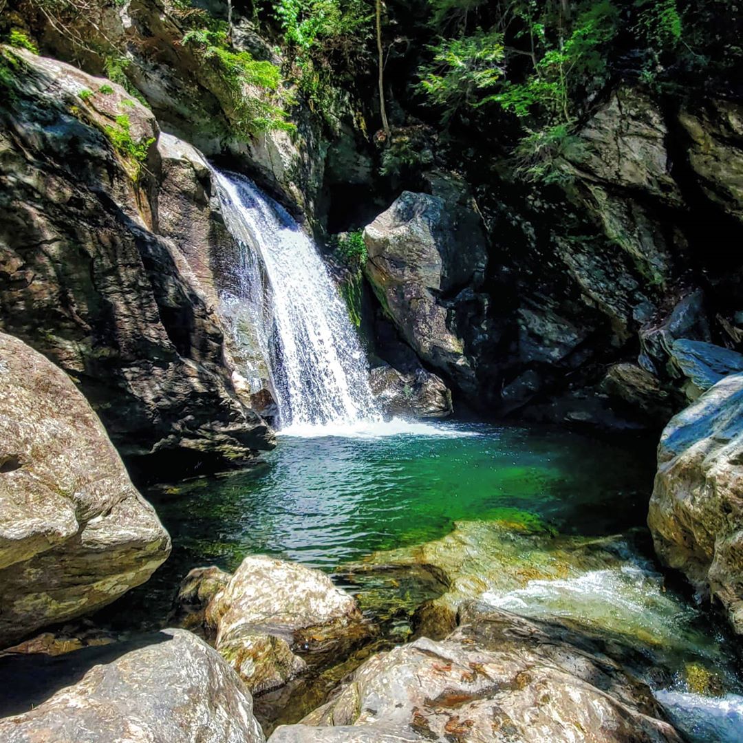
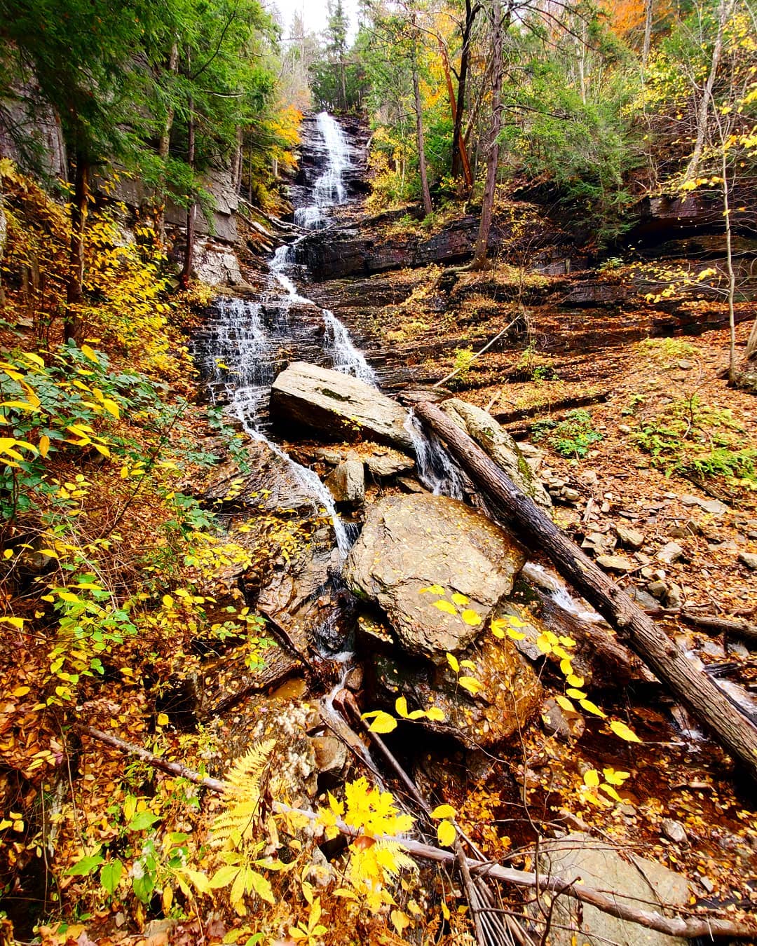
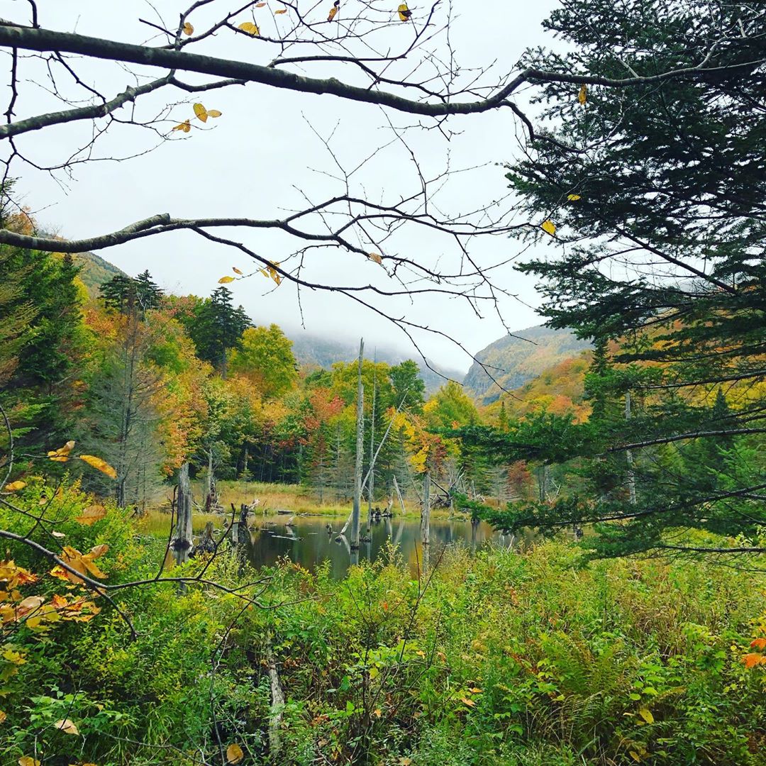
5. Moss Glen Falls
2,000 Monthly Searches
COVID-19 less popular alternative: Cady Hill Forest
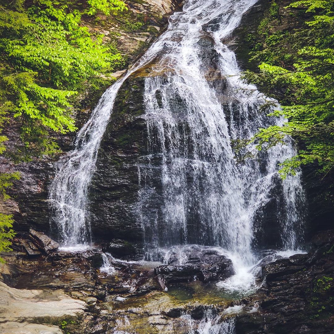
Sherry: I haven’t been there for about ten years, it’s on State Land, in CC Putnam State Forest, and it’s a hike in (2-3 miles in). If you want to get away from the crowded areas in Stowe, take a ride just outside of downtown Stowe, heading north on Rte. 100 (get directions), hike out here, it’s a beautiful place to go. Or, if you’re passing through Stowe, it’s an amazing place to get out and take a trek to on a hot day. Shady with its geological formations a definite must see as words just can’t describe the sensation.
There’s another Moss Glen Falls in Granville Gulf. Perfect place for a picture.
You’ll have more probability of seeing a moose in Granville Notch than other central Vermont areas.
(The Recreational Trails Program that I manage will support work at Bingham Falls this year, on Rte. 108 in Stowe, for a portion of the trail here that needs maintenance work)
Amy: A really nice easy one, it goes out to a really big waterfall. I tell families with kids to do it. It’s really flat making it an easy hike for kids.
6. Mount Tom
1,900 Monthly Searches
COVID-19 less popular alternative: Eshqua Bog Natural Area
Check here for the latest advisory before you go.
Sherry: We’ve only got one National Park in Vermont, and it’s in Woodstock. Mount Tom’s trails are part of the National Park and are very accessible through a system of old carriage roads.
The Marsh-Billings National Park in Woodstock is a must-see for the history.
Check out the amazing home, the Marsh-Billings-Rockefeller Mansion, once owned by Mary & Laurance Rockefeller. Mary and the women in her family served as leaders in land conservation and stewardship, not just Mary’s home but of their land.
Mt. Tom is a part of the Marsh-Billings Rockefeller National Historic Park, and you can reach its summit via the Faulkner Trail, or you can experience on foot the trip taken by old carriages, along old carriage roads from the base of Mount Tom which will lead to the summit as well.
Be sure to visit Marsh Billings Rockefeller National Historic Park and hike Mt. Tom. You’ll discover how important land conservation is, and how a sense of place makes a difference to people from one generation to the next.
Amy: That’s a great one for families as well. It looks over Woodstock, a quintessential Vermont town. It’s really easy even though you’re going up a mountain.
Stephanie: When people say they’re going to hike Mount Tom, they usually mean they’re going to hike up to South Peak, which is one of several peaks of Mount Tom. From South Peak, you have a phenomenal view of the town of Woodstock, one of the most charming NE towns in the region. In the winter it looks like a snowglobe. Most people are hiking for views at the top. When I want a little quieter experience, I hike North Peak, which doesn’t have the view, but has lovely rock outcroppings, and more of a mossy forest vibe. One of the routes to either peak will take you by the Pogue, which is the mountain lake here in the park. It used to be a wetland, but in the late 1800s it was dammed to become a lake. It’s a great place to see fall colors reflected on the pond. The origin and meaning of the name “Pogue” are obscured in history.
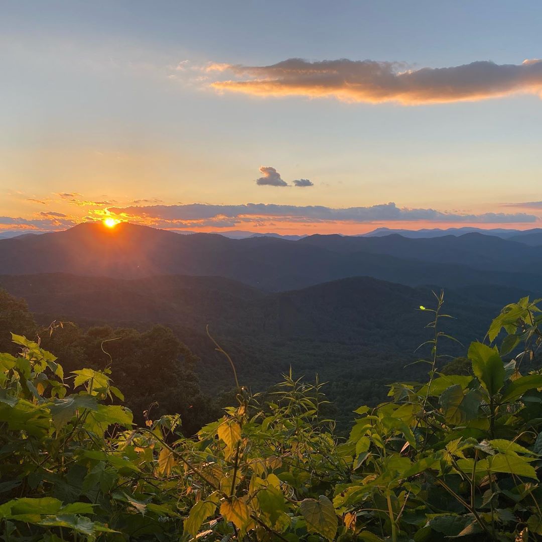
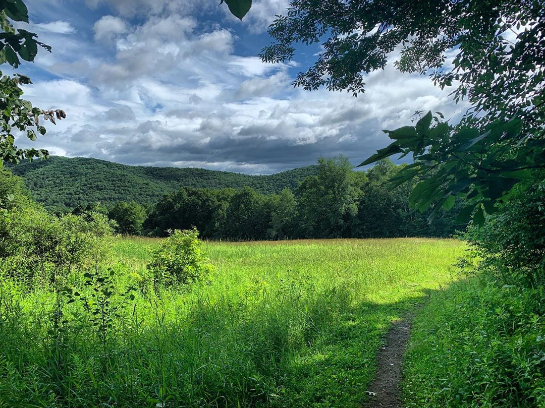
7. Green Mountains
1,800 Monthly Searches
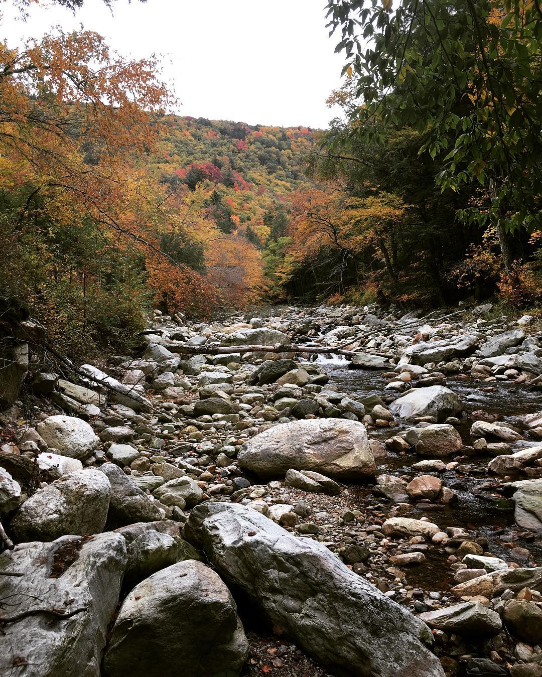
Sherry: I like to call the Green Mountains the backbone of Vermont. The Green Mountains extend from southern Vermont all the way through Vermont to the Canadian border. A long portion of the Long Trail stretches across the ridge of the Green Mountains, and you will find Vermont’s highest peaks in the Green Mountains.
It’s fun to drive up, over, and through the Gaps of the Green Mountains. Some people bike the gaps. And in the winter time, when some of these gaps get closed to traffic, they make great places to explore on skis and snowshoes. Take Route 100 and discover Brandon Gap, Middlebury Gap, Roxbury Gap, Lincoln Gap, App Gap (“Appalachian Gap”), and Smugglers Notch are all worthwhile and will take you east to west of the green mountains, and to areas where you can hike a bit of the ridge line of the Green Mountains. One spot I like to go just for a sunset is Sunset Rock from Lincoln Gap. Park at top of Lincoln Gap and take the trail south, about ½ mile to Sunset Rock.
Stephanie: I’ve hiked in the Green Mountains… Vermont and NH have their separate paradigms of the White and Green Mountains. The White Mountains are made of granite, which gives them that bright white appearance. The mountains in Vermont are a little more geologically diverse. They have more subtle outcroppings, blanketed by beautiful forests and intersected by streams. The Greens are some of the most iconic mountains in the state.
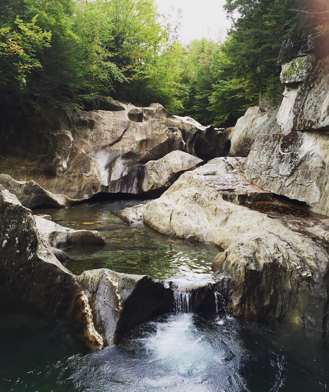
8. Bingham Falls
1,200 Monthly Searches
COVID-19 less popular alternative: Wiessner Woods
Check here for the latest advisory before you go.
Sherry: It’s in Stowe, another amazing waterfall. Highly used, stay on the trail. It always is needing trail work because it gets such high use. We’re going to be doing more work there this year. It’s one of the most highly-visited trails in Vermont, and it’s on your way up to Smuggler’s Notch, with limited parking. I think if you’re looking for waterfalls, but the trailhead parking area is full, you can travel a little further to Moss Glen Falls, and you’ll have a little more privacy to the waterfalls.
Amy: Another really cool waterfall, I like it a little more than Moss Glen. The waterfall has really cool eroded rocks.
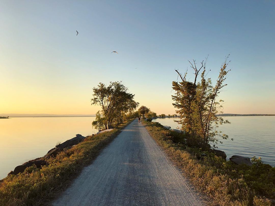
9. Burlington Bike Path
1,100 Monthly Searches
Check here for the latest advisory before you go.
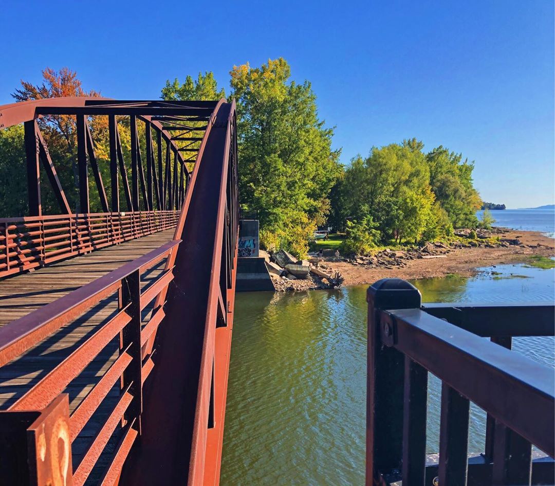
Sherry: I get out on the Burlington Bike Path at least once/year and take it all the way to the end of the Island Line Trail (from Burlington to South Hero). I get on in Burlington, at Oak Ledge Park, bike ride along the bike path adjacent to Lake Champlain, through Waterfront Park then up to North Beach (which becomes now the Island Line Trail), up through Leddy Park, then to Starr Farm Park, and eventually over the Winooski River Trail Bridge and over to Airport Park in Colchester which will link you over to the Colchester Causeway, a two-mile strip of the bike path that goes out over Lake Champlain. I get on the ferry with my bike (it’s a bike ferry) to get to South Hero and can check out the island (South Hero, North Hero, Grand Isle). One of my favorite summer-time rides. I think I’m smiling the whole time. It’s the most amazing bike ride. Full day trip from Burlington to the island and back is about 28 miles. Once on the Causeway, you have the most amazing vista of the Adirondacks in NY. It’s an experience of a lifetime. You have lake view, all the way from downtown Burlington, just about the whole way. There’s so much you can do along the way, or before and after. I feel like I’ve been on a get-away vacation when I bike here all day long.
You get a beautiful breeze, so if it’s a 95-degree day in the summer it’s the best place to be.
10. Warren Falls
17,000 Monthly Searches
COVID-19 less popular alternative: Bristol Falls
Sherry: I used to live near Warren Falls in the 1990s, and it was the place everyone went to. Back then it wasn’t formalized. But since then the Green Mountain National Forest gave it a parking lot and made it a great place for people to go and spend the day. Great place to go for a swim, and you can go mountain biking or hiking nearby. My oldest son just got married, and their wedding reception was in Warren. We rented a house in Warren for the week. The whole family and friends did daytime adventures and we’d then meet up at Warren Falls to take a swim before heading back home.
Amy: A really cool swim hole, not so much of a hike. One of the best swim holes in Vermont and it’s really fun, but it can be busy.
11. Merck Forest
17,000 Monthly Searches
COVID-19 less popular alternative: Griffith Lake Trail Head
Check here for latest advisory before you go.
Sherry: I haven’t personally been here, but I’ve been told the Merck Forest is like an enchanted forest area. Trails were built and maintained by Vermont Youth Conservation Corps through the Recreational Trails Program years ago. Apparently, there’s places to camp and hike and learn all about forest health.
Keld: Merck Forest was started by George Merck back in the mid-50s. We have about 3300 acres of land, with seven or eight cabins in it. We just built a new one, a copy of Thoreau cabin, as accurately as we possibly could. It’s a nice place to go to meditate for a night by yourself. We have about 30 miles of hiking trails that we maintain, lots of room to spend a week. Two of our hikes go to the top of mountains, there’s Antone and Gallop Mountain. You can hike, horseback ride, ski, and whatever you need to do out there. There’s no charge to hike there, but we love people to join as members too.
12. Killington Peak (Bucklin Trail)
17,000 Monthly Searches
COVID-19 less popular alternative: Aitken State Forest
Sherry: Very steep! Killington Peak is the 2nd highest peak in Vermont (a must do). I’ve hiked the 5 highest peaks and took the Bucklin Trail up to Killington Peak. Challenging, but very fun.
The ski resort has made an amazing mountain bike park trail system for those who want to learn (beginners) all the way to extreme mountain biking from the top of Killington (peak). When I saw what people are doing on their bikes from the summit, I was thinking, “How can they do that?” It’s cool to watch, there’s so much going on there at this resort. One side of the mountain is commercial, and on the other side of the mountain, where the Bucklin trail is, it is public, and open for hikers like me.
But whether you’re becoming a new mountain biker or are an extreme one, or you’re a skier, snow-shoer or hiker you can access trails up to Killington Peak and enjoy every moment. There are nearby easy connections and linkages: There’s Deer Leap trail, it goes up to Sherburne Pass on Route 4 from Gifford Woods State Park in Killington, on Rte. 100.
If you stay at Gifford Woods State Park, they have an old growth nature trail, with old growth trees that remain, left over from, when most trees were de-forested from Vermont’s landscape over 200 years ago.
Amy: Killington is a really cool peak; Bucklin trail is actually pretty moderate. The 0.2 mile spur trail that goes up to the summit is the hardest part of the whole hike; it’s a very steep, hand over hand scramble to the top. Nice 360 views, and one of the oldest Long Trail Shelters called Cooper Lodge. That one’s an old stone one. The lodges in general are fun to go and sit inside; if it’s windy or cold, to get out of there.
13. Equinox Mountain
17,000 Monthly Searches
COVID-19 less popular alternative: Prospect Rock Trail
Amy: It can be pretty busy in the summer. It’s the highest mountain down in the Equinox Range.
Keld: That’s on the other side from the Green Mountain Range. I live in the valley in the middle. It’s a little more than 3,800 feet elevation at the top. It’s a pretty relentless hike, you have to be a decent hiker to do that. At the top you have a fantastic view out over the whole valley. There’s a meditation center on top that was built by the local monks. There used to be a hotel up there, but that was taken down for the center. I like to go up there, I bring my dog. There’s an old spring half way up there. Many years ago, someone put a pipe up there for the water to exit. You can drive up there too. The country’s longest private toll road comes up the mountain from the other side.
14. Stowe Pinnacle
17,000 Monthly Searches
COVID-19 less popular alternative: Cady Hill Forest
Shelby: They get 30,000 visitors a year, it’s a really popular hike. In March we’re going to be conserving the eastern half of Hunger Mountain, which Stowe Pinnacle overlooks. We’re going to be expanding the state forest to ensure that the views from the top remain this high quality hiking experience. Most of the property is off the trail. It’s the CC-Putnam State Forest that the Stowe Pinnacle Trail goes through.
Amy: I love Stowe Pinnacle. It’s moderate. Because it’s part of the Worcester Range, you get great views of the Green Mountain Range. You’re looking out over Mansfield and Camel’s Hump.
15. Lye Brook Falls
17,000 Monthly Searches
Check here for the latest advisory before you go.
Keld: The Lye Brook Trail is 2.5 miles out to the falls, or you can continue out to Bourn Pond higher up, which is about 7 miles. Most people go to the falls. It’s called the Lye Brook Trail, and that’s about 5.4 miles round trip with 1,100 feet of elevation. It’s in the Lye Brook wilderness. It’s Vermont’s 2nd tallest waterfall, and it runs very heavily in the spring and early summer. On the way up, if you know what to look for, there’s an old railroad that used to take lumber out of there. A few years ago, we had our big hurricane that came through, and there was a humongous landslide out there and people thought we lost the falls, but the slide just missed it. It’s a heavily-used trail because it’s short and easy to get to.
16. Colchester Causeway
17,000 Monthly Searches
Check here for the latest advisory before you go.
Amy: That’s awesome. It’s mostly a bike path. It goes out in the middle of Lake Champlain. It’s the coolest bike path that I’ve ever been on.
17. Mount Ascutney
17,000 Monthly Searches
Check here for the latest advisory before you go.
Shelby: Mount Ascutney is an amazing story of a really problematic situation where a ski resort defied the will of a community Vermont but eventually experienced foreclosure. We were involved in helping the Town of West Windsor acquire a large portion of Mount Ascutney that was comprised of the Ski Resort, so they could expand the forest to include the Ascutney footprint. There’s now Ascutney Outdoors, it’s a playground for a wide spectrum of folks. In the winter, they have everything from really expert back-country skiing, they installed a chairlift, they have a rope tow, they have a sled hill. Since the community moved almost unanimously to expand the town forest to include all of Mount Ascutney, it’s home to Slate Valley Trail System. It’s a hive of activity. The town bought it, they’re now doing all this four season recreation activity, the town general store is back in business and thriving. You go into the Ascutney outdoors’ little community center, and there’s a skinning etiquette poster, sign-in for back country skiiers. It’s a very Vermont, very homegrown, sweet little scene.
Amy: I got engaged up there. It’s basically the biggest mountain you’ll find in the upper valley. It’s under 3,000 feet, but it is a monadnock, so it looks huge because there are no other mountains around to compare to. It has a Fire Tower, so you can see into the White Mountains and the Green Mountains.
18. Stowe Recreation Path
17,000 Monthly Searches
Check here for the latest advisory before you go.
Amy: That goes along the river in Stowe. It’s about 5 miles one-way; you get great views of Mansfield, you can stop at restaurants along the way.
19. Mount Hor
17,000 Monthly Searches
COVID-19 less popular alternative: Burke Mountain Trail
Amy: It’s a moderate hike up to an outlook, not 360. There are great ski options down for winter time.
20. Glastenbury Mountain
17,000 Monthly Searches
COVID-19 less popular alternative: George Aiken Wildflower Trail
Amy: It’s down in Southern Vermont; there’s a firetower up there. Glastenbury Wilderness is one of the most remote places in Vermont, and one of the longest stretches on the Long Trail without any road crossings. It isn’t usually done as day hike, because it is over 20 miles round trip to summit, so it is usually done as an overnight. There’s a shelter near the summit to stay in.
21. Spruce Peak
17,000 Monthly Searches
COVID-19 less popular alternative: Laura Cowles Trail
22. Falls of Lana
17,000 Monthly Searches
COVID-19 less popular alternative: Robert Frost Wayside
Amy: I did that a few years ago; really cool waterfall, really easy to get out to me.
23. Lamoille Valley Rail Trail
17,000 Monthly Searches
COVID-19 less popular alternative: Hardwick Trails
Check here for the latest advisory before you go.
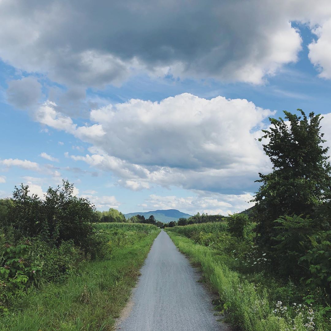
Amy: It’s pretty large; I’ve biked parts of it. You can stop at different restaurants, and that’s the appeal to me: to bike to a restaurant and bike back.
Sherry: A must bike ride! My favorite is getting on in Morrisville, going all the way to Cambridge, get a bite to eat, stop off at the bike ride visitor center in Johnson and see the village too, then get back on and stop at Lost Nation for a cold drink and appetizer). Don’t miss getting out on the section from St. Johnsbury to Danville, too. Lamoille Valley Rail Trail excursions are adventures to do when you want to bike, walk, or run for miles and experience the beautiful rural landscape of Vermont.
Fabulous summary of wonderful places to enjoy nature in VT.
One correction as a member of Ascutney Outdoors and a 51 yr resident of Brownsville. We have a T bar not a chairlift. As you stated amazing community effort to resurrect this fabulous mountain
Enjoy nature Its there for all of us to use.
Ray
Thanks Ray, fixed it!